NEIGHBOURHOOD EVIDENCE: FLOODING

INTRODUCTION
Our document shows a range of flooded streets across Pinhoe as documented by residents over a two year period: August 2020 to end July 2022.

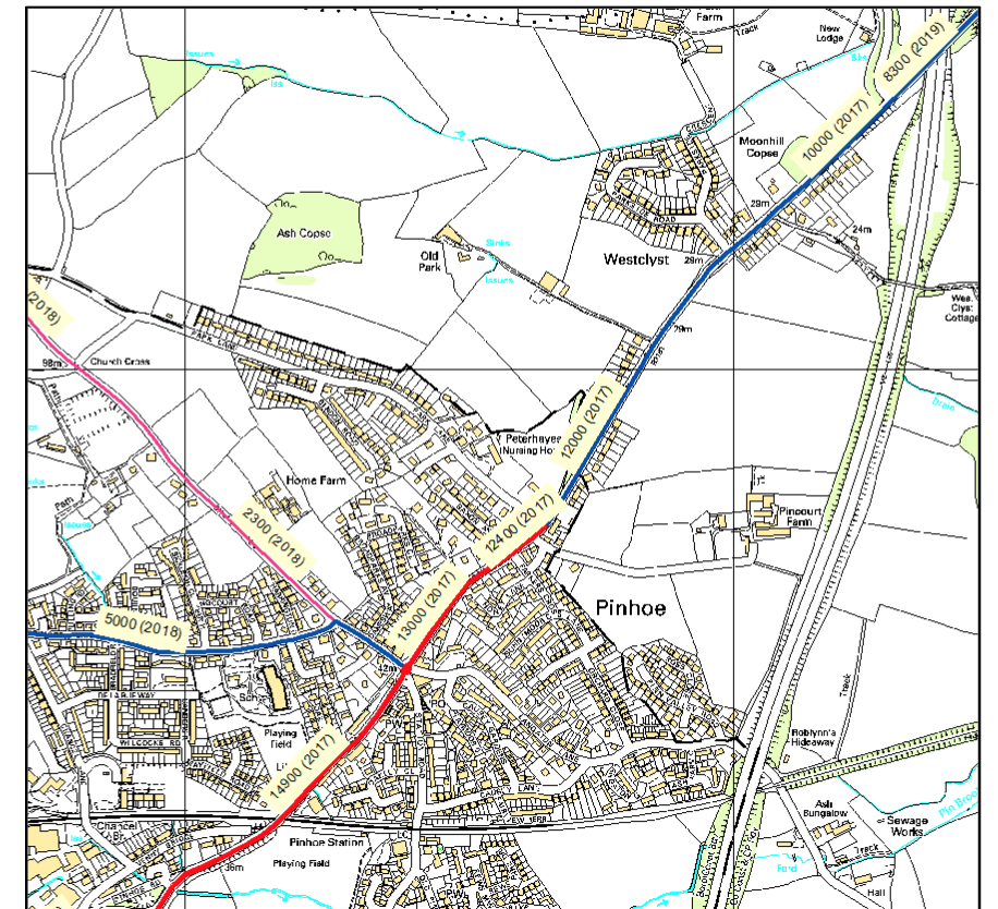
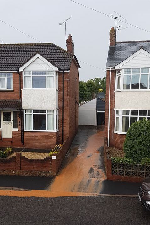
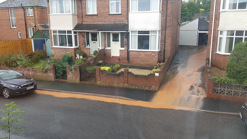
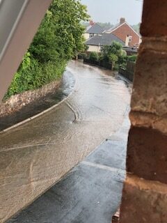
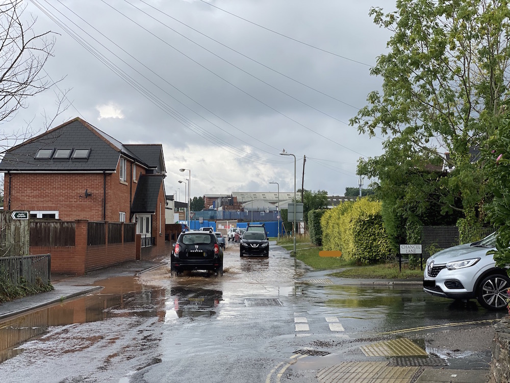
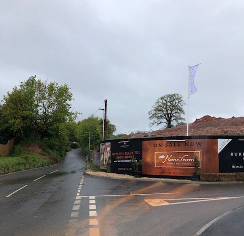
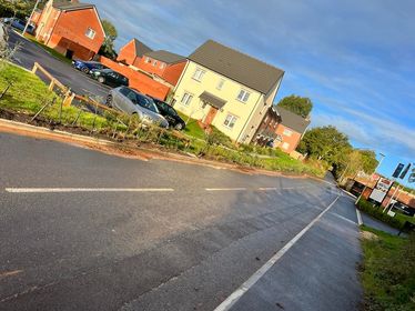
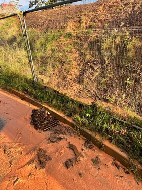
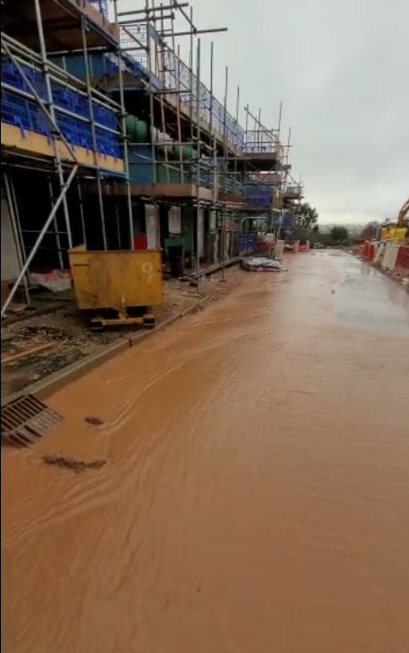
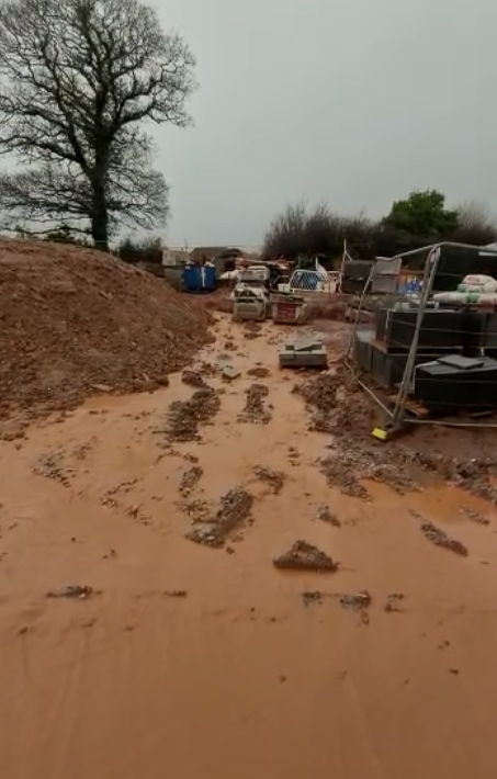
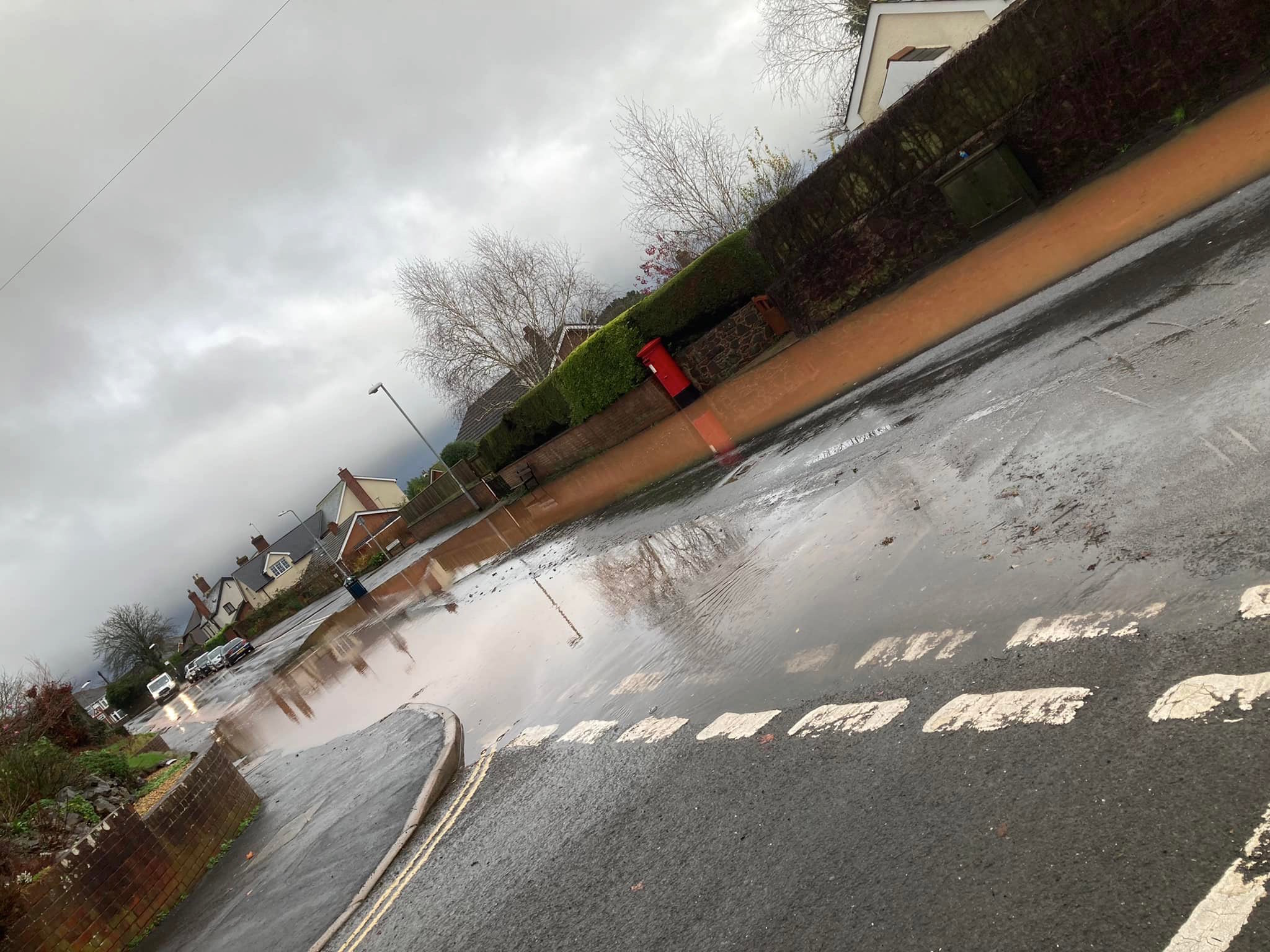
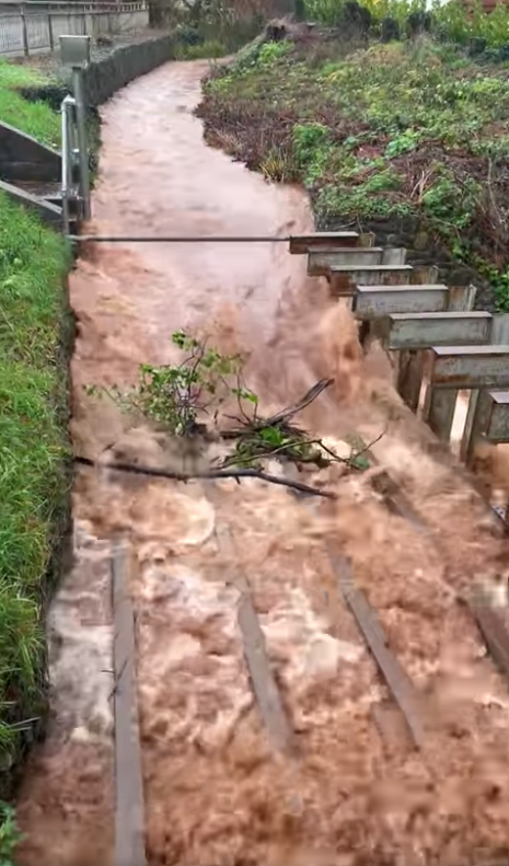
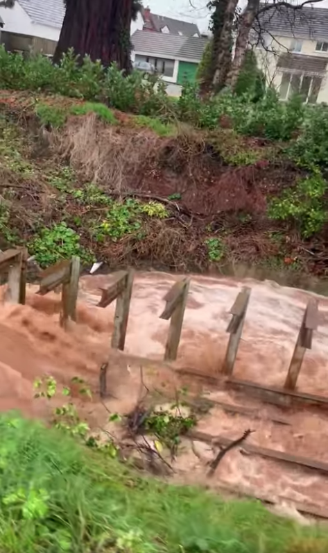
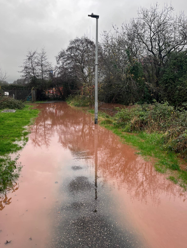
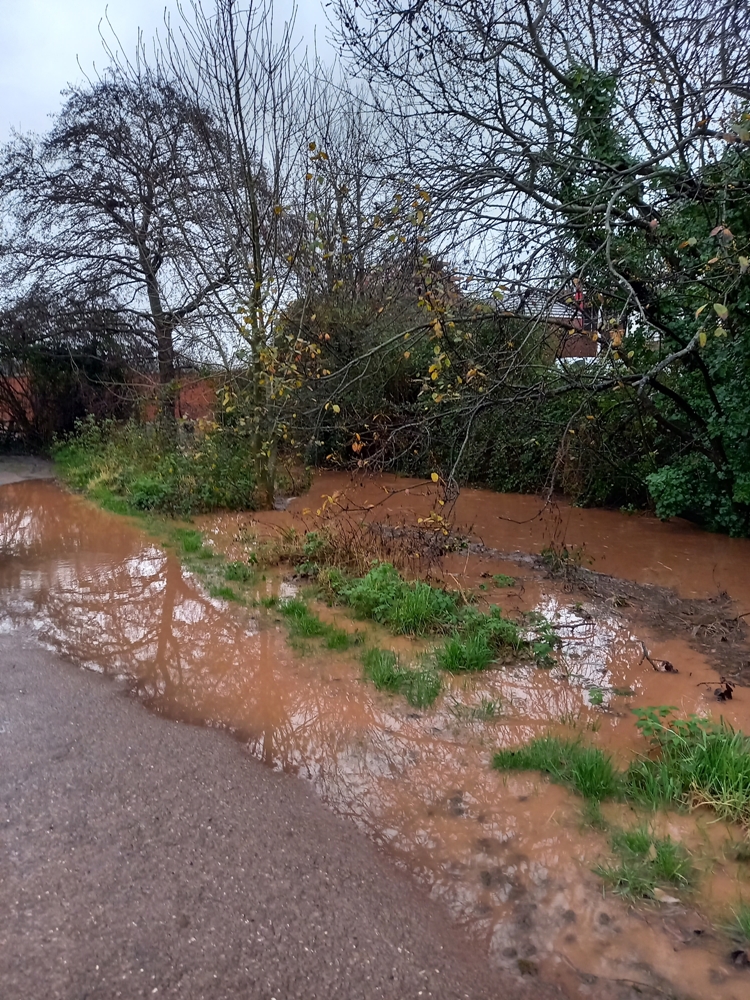
The current Home Farm development sits immediately below Higher Field. Flood water empties into Church Hill and Danesway, before travelling down Station Road, Causey Gardens and into Causey Lane. Drains are regularly blocked by silt and sediment. Flood waters also empty into Harrington Lane, De La Rue Way and Lower Harrington Lane by Pinhoe Library (Main Road).

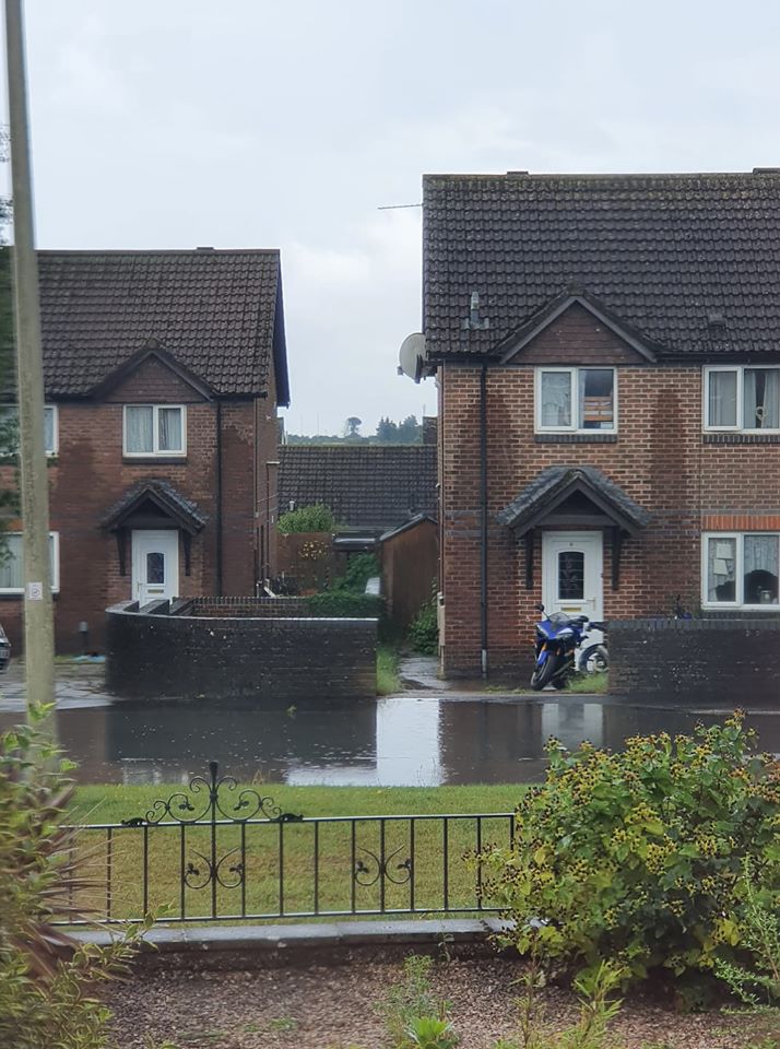
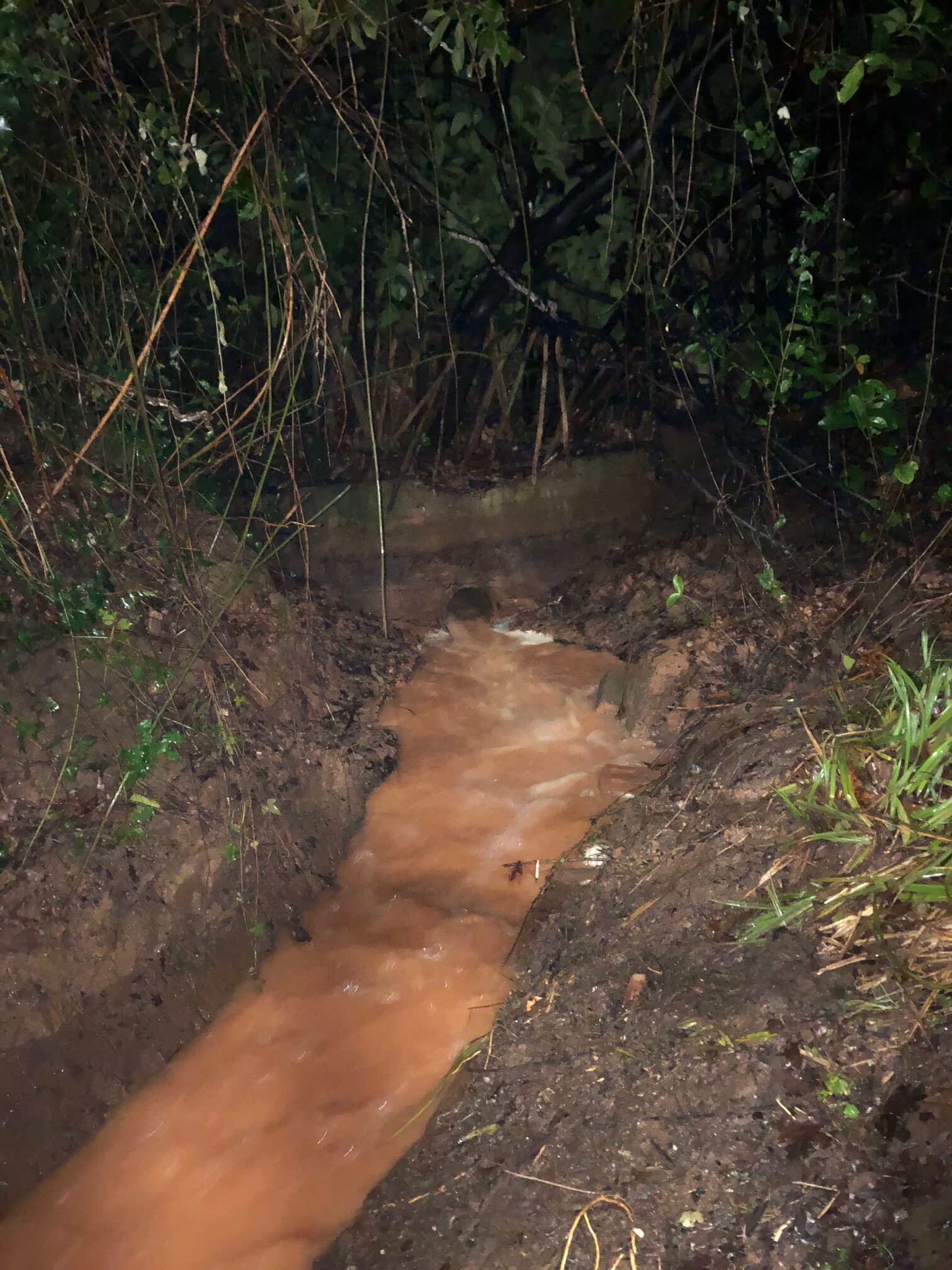
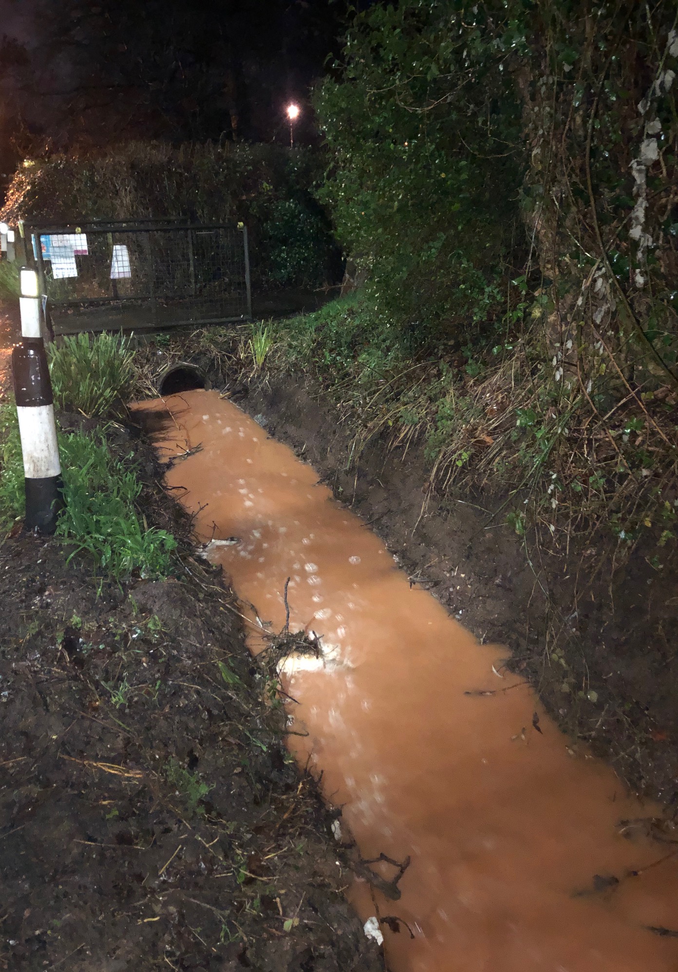
When the network capacity is flooded it affects Pinn Brook across the area including Venny Bridge, through Station Road Playing Fields and into Monkerton via Old Pinn Lane. The impact of sediment pollution on Pinn Brook waterway and environmental receptors along its nature network is yet to be investigated.

CONTEXT
Pinn Brook is classified as a Main River and is managed by the Environment Agency; it is the major watercourse in Pinhoe. Higher Field lies within the Pinn Brook catchment area.

NOTE 1: As reported in the RB Nelder Trust and Waddeton Park Ltd Statement of Community Involvement 2013 > “Residents expressed concerns about additional flooding and storm drains which cannot currently cope with the amount of run off – the new development would significantly increase this.” Mrs Pike: “We are concerned that the developer will be taking out swathes of Devon hedgerows and mature trees if he widens the road as he will need to do to get a decent span on the road. How much habitat will be lost?”
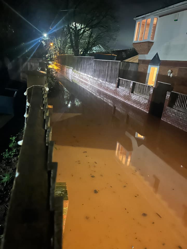
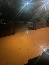
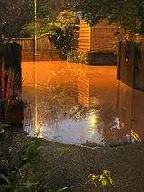
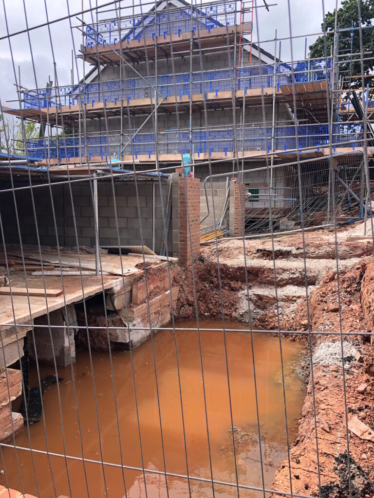
NOTE 2: Following a month of dry weather with limited rain, photo evidence was submitted after limited rainfall on 23 July 22, showing water accumulating in the underbuild of the coach house, one of the final properties being built on Home Farm site near Church Hill, three units down from Higher Field.


Home Farm, July 2022

SUMMARY
• Evidence submitted by residents shows persistent flooding from the current Home Farm site.
• This flooding is damaging property and impacting road safety.
• As extreme weather events increase in regularity and severity, modelling exercises to develop flood plans and Strategic Flood Assessments will need to ensure protection for resident safety and property security across a wide area across Pinhoe, as this evidence demonstrates.
• Hedgerows and hedge trees provide excellent weather barriers and habitat for wildlife; as part of natural flood management they significantly increasing water infiltration rates into soil, reducing surface run off and overland flow. Hedgerows help to prevent soil erosion and stop soil sediment reaching rivers. The removal of multiple sections of tall Devon hedgerows is contributing to compromised effectiveness of water management measures on the current site. Further reduction of existing green infrastructure not only damages the character
of the natural landscape but would further exacerbate flood water flow.
• The case for the retention of Higher Field as protected greenspace, with enhanced protection for boundary hedgerows and field trees is made stronger by this evidence from our local community and more urgent by the undeniable impacts of climate change.

Traffic Policies for Pinhoe

Pinhoe is the connecting point for traffic travelling from Exeter to East Devon, to Broadclyst but also to Cullompton, as well as connecting towns and villages across Mid Devon to the M5 motorway. Commuter traffic cuts directly through the village centre. Despite being within the electoral boundary, Monkerton is not included in current highways strategy planning for Pinhoe

PINHOE AREA ACCESS STRATEGY & ADDENDUM
The Highways plan developed by Devon County Council was published as the Pinhoe Area Access Strategy (PAAS) in 2013, and updated with an Addendum in 2019

DCC: “The strategy was created to support the Exeter and East Devon Local Plans and ensure that planned development in the Pinhoe area would be supported with appropriate and effective transport infrastructure measures.

“Since the PAAS was written, a number of the planned developments have come forward and much of the identified transport infrastructure delivered. There has also been additional development beyond that initially planned for and the designation of a Village Green on part of Eastern Fields prevents the Exhibition Way Link Road, one of the key mitigation measures.(see further info below)

PINHOE AREA ACCESS STRATEGY (PAAS) (available as a complete document here)
estimates 100 vehicles per hour using Harrington Lane at peak times, and queuing traffic of up to 50 vehicles at the double roundabouts during peak times

PAAS ADDENDUM (available as a complete document here)
“The purpose of this addendum is to refresh the strategy to reflect current priorities and to identify additional transport measures that are required to continue to support sustainable development in the Pinhoe area.” Prepared by Liz Holloway, Senior Transport Planning Officer at Devon County Council, in 2019

EXETER TRANSPORT STRATEGY PDF available here (17 pages)
Published by Devon County Council in November 2020, elements of PAAS have been superseded in the Exeter Transport Strategy, notably the designation of Langaton Lane as a GREEN LANE.

“The County Council has made good progress in delivering this strategy, with approximately £100 million of new transport infrastructure for the Exeter and East Devon Growth Point area since 2011. This has included motorway junction improvements, strategic cycling infrastructure, new bus services and new rail stations.”

INFLUENTIAL PLANNING DECISIONS
In 2016, the Planning Inspectorate recognised a section of Eastern Fields as a ‘Village Green’ under the Commons Act of 2006, following a long campaign by local residents. (Appeal decision document available here). This meant that the planned route to mitigate traffic along Harrington Way, the new Exhibition Way road, could not be built.


Following a Freedom of Information Request (FOI) by Pinhoe Forum in 2020, Devon County Council released the following map showing Pinhoe Annual Average Daily Traffic (AADT) Flows:

LOCAL MONITORING
By August 2021 over 1200 vehicles per hour travelled through the double roundabouts during rush hour 5-6pm
In July 2022, volunteers monitored 1344 travelling across the double roundabouts with a further 706 vehicles using Church Hill.

If you’d like to monitor traffic in a specific area, please get in touch for clickers and monitoring forms

Local Masterplans

A master plan is a long-term planning document that gathers information to provide a detailed framework to guide future growth and development in a specific location. It takes an overview of a defined area and sets out general principles for how that area will be developed, including directions for the provision of highways and green infrastructure, alongside setting standards for the range of buildings and their uses, densities and heights.


• MONKERTON & HILL BARTON MASTERPLAN
Described by Exeter City Council as designed “to guide the future development of a sustainable urban extension to the north east of the city. It will supplement policies in the adopted core strategy .. and will be important for guiding future planning applications for the site. The Masterplan has been produced to enable to comprehensive development of this area through the planning process”

The consultation period ran from 1 March to 12 April 2010. It was approved by Exeter City Council Executive on 28 September 2010 and 23 November 2010.

Monkerton Masterplan was NOT formally adopted by Exeter City Council, resulting in a series of challenges and problems due to a lack of agreed development standards

Available online: https://exeter.gov.uk/planning-services/major-schemes/monkerton-hill-barton-masterplan/


• CLYST VALLEY REGIONAL PARK MASTERPLAN
This award-winning 25 year masterplan covers an area half the size of Exeter, beginning at Pinhoe’s boundary edge with East Devon District Council.

“Devon is well-known for its countryside with national parks, areas of outstanding natural beauty, estuaries and beautiful coastline. But there is greater pressure than ever on these stunning locations. With a growing population, it is necessary to provide much-needed homes, jobs and infrastructure. As more people explore the countryside, it is imperative that we protect and enhance our green spaces because getting active outdoors keeps us healthy and happy, plus the countryside can help us address climate change by storing carbon and water, as we work towards becoming carbon neutral by 2040”

The concept of the Clyst Valley Regional Park is that a number of greenspaces will be linked by greenways. There is no intention that the whole of the Regional Park will become accessible to the public, as most of it is in private ownership. However, 762 hectares is currently accessible and the ambition is to increase that by a further 740 hectares over 25 years. A large proportion of the Regional Park is within the National Trust’s Killerton estate. 40% of the Regional Park is within a floodplain.
The concept of the Regional Park originates from the Green Infrastructure Strategy (Exeter & East Devon Growth Point Team, 2009). The diagram below is taken from this strategy and shows the ‘clyst meadows’ as a “well defined network of accessible semi-natural greenspaces and less accessible biodiversity rich areas…creating a strong buffer between [Exeter] and the countryside”.

Downloadable pdf (92 pages)https://eastdevon.gov.uk/media/3722704/cvrp-masterplan.pdf