NEIGHBOURHOOD EVIDENCE: FLOODING

INTRODUCTION
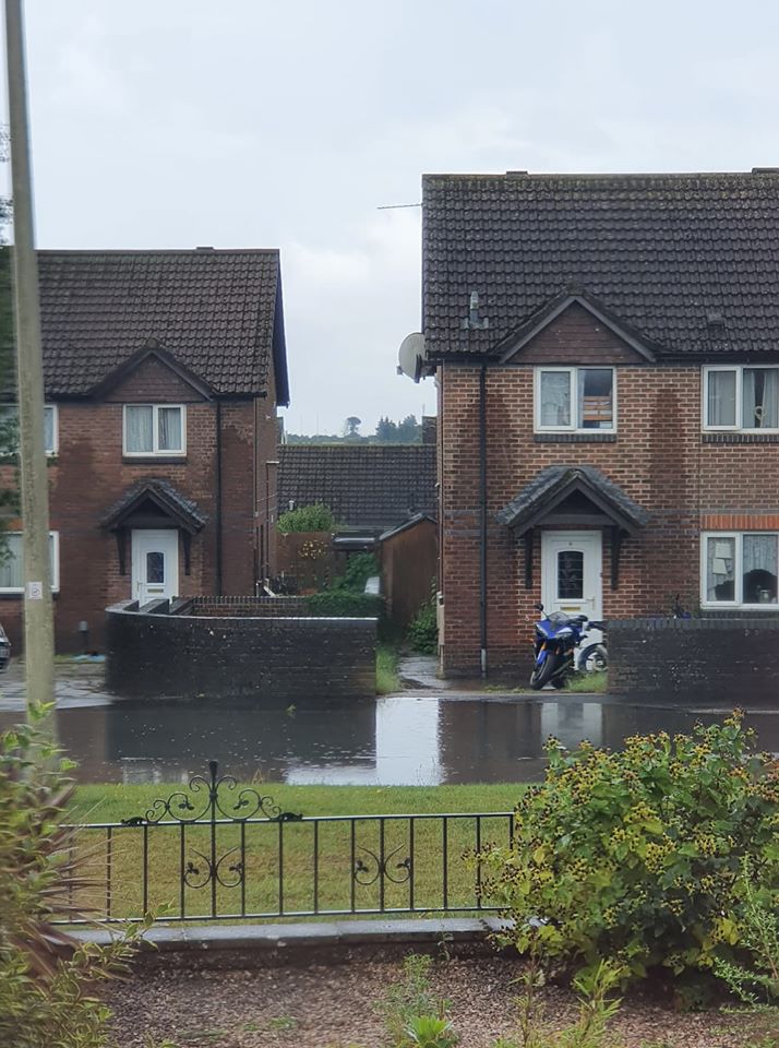
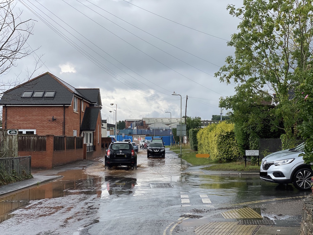
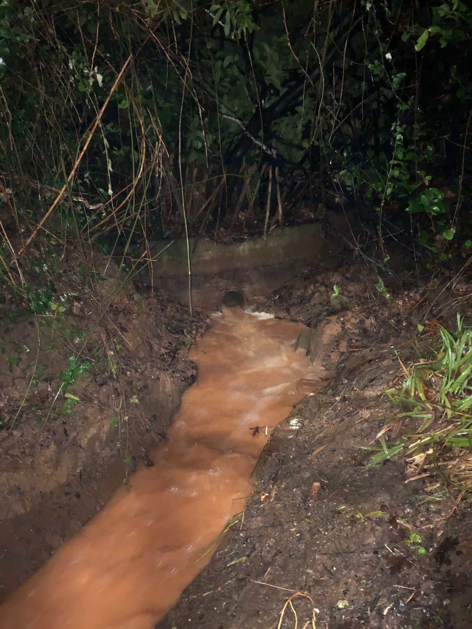
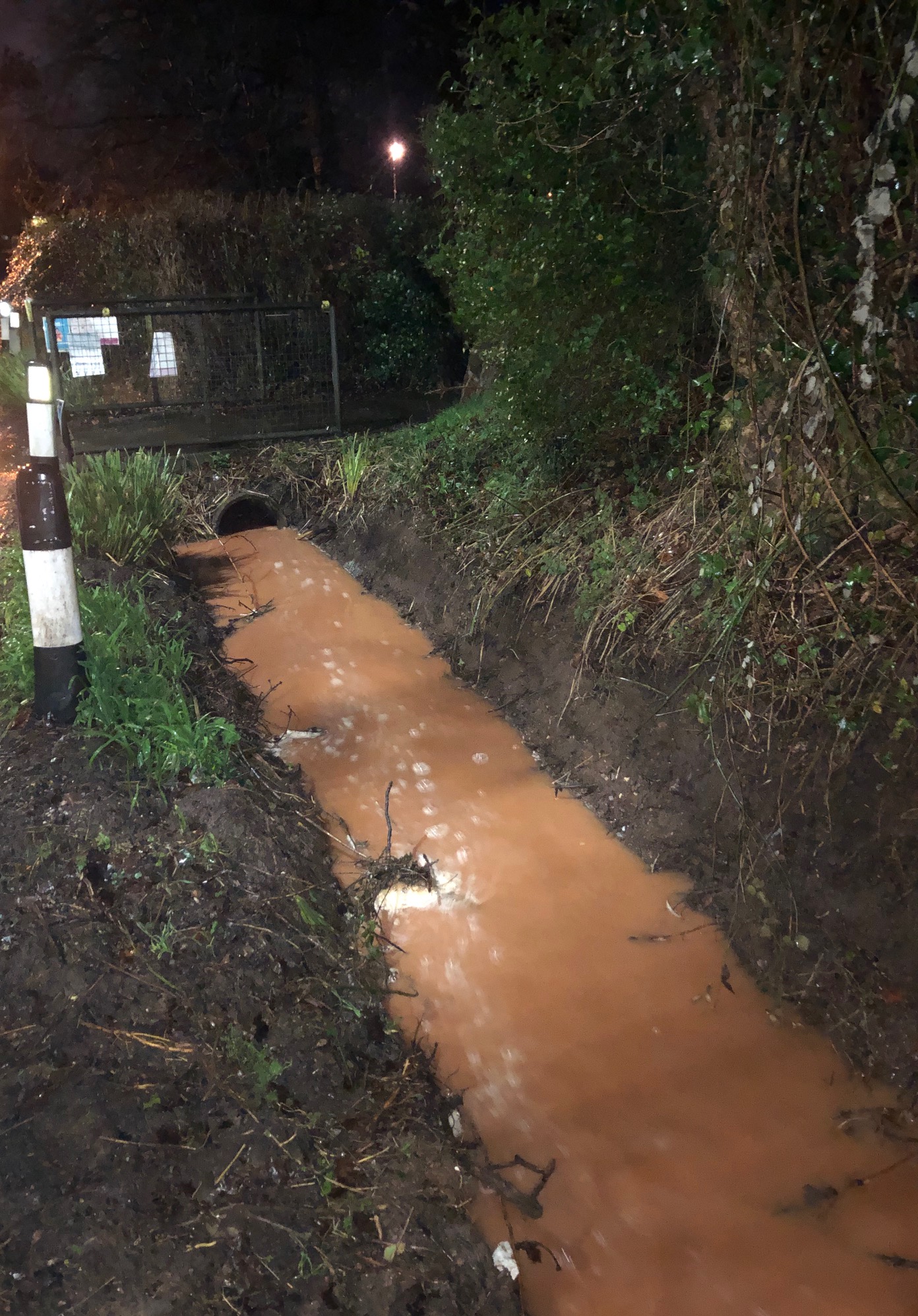
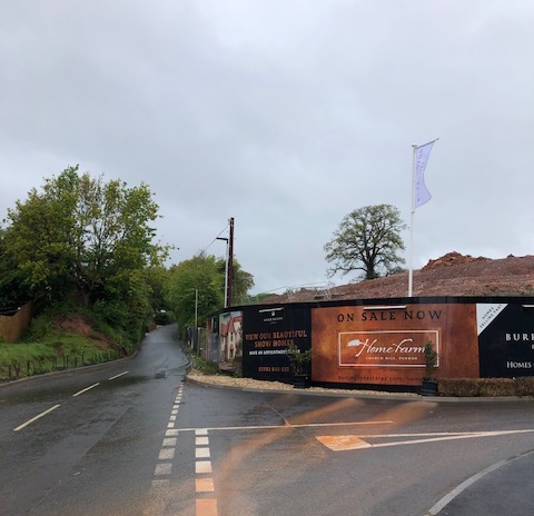
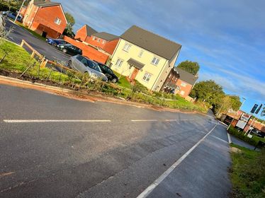
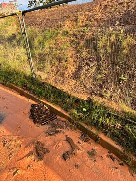
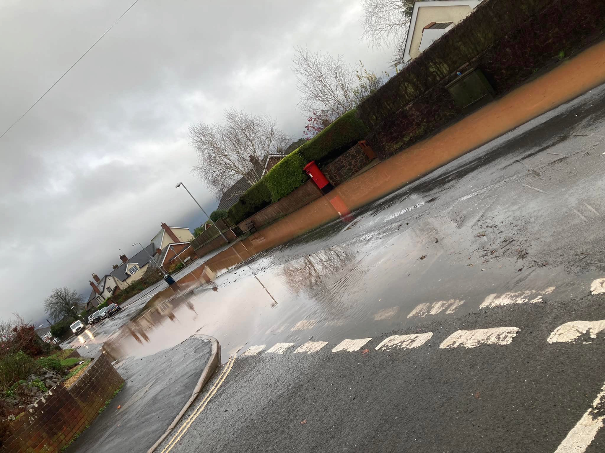
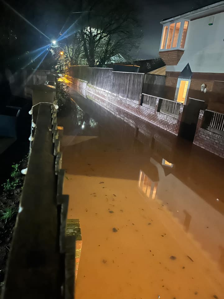
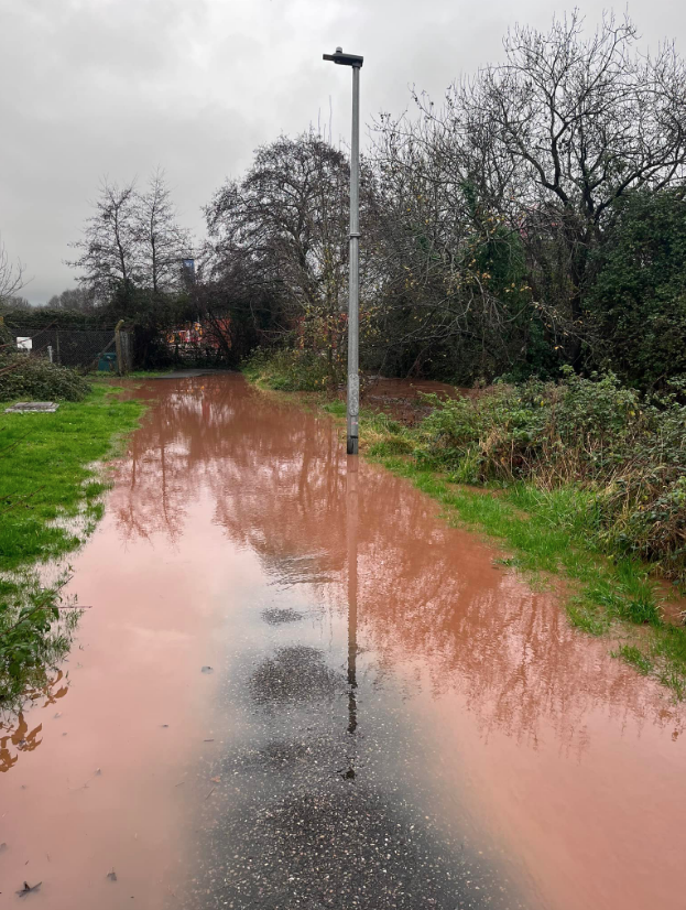
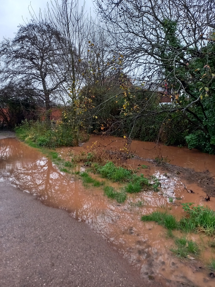
Our document shows a range of flooded streets across Pinhoe as documented by residents over a two year period: August 2020 to end July 2022.

The current Home Farm development sits immediately below Higher Field. Flood water empties into Church Hill and Danesway, before travelling down Station Road, Causey Gardens and into Causey Lane. Drains are regularly blocked by silt and sediment. Flood waters also empty into Harrington Lane, De La Rue Way and Lower Harrington Lane by Pinhoe Library (Main Road).

When the network capacity is flooded it affects Pinn Brook across the area including Venny Bridge, through Station Road Playing Fields and into Monkerton via Old Pinn Lane. The impact of sediment pollution on Pinn Brook waterway and environmental receptors along its nature network is yet to be investigated.

CONTEXT
Pinn Brook is classified as a Main River and is managed by the Environment Agency; it is the major watercourse in Pinhoe. Higher Field lies within the Pinn Brook catchment area.

NOTE 1: As reported in the RB Nelder Trust and Waddeton Park Ltd Statement of Community Involvement 2013 > “Residents expressed concerns about additional flooding and storm drains which cannot currently cope with the amount of run off – the new development would significantly increase this.” Mrs Pike: “We are concerned that the developer will be taking out swathes of Devon hedgerows and mature trees if he widens the road as he will need to do to get a decent span on the road. How much habitat will be lost?”
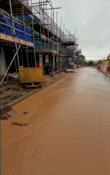
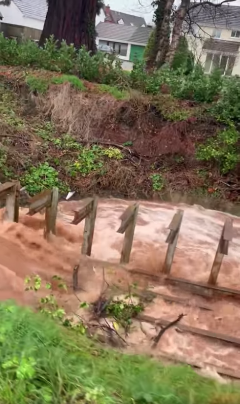
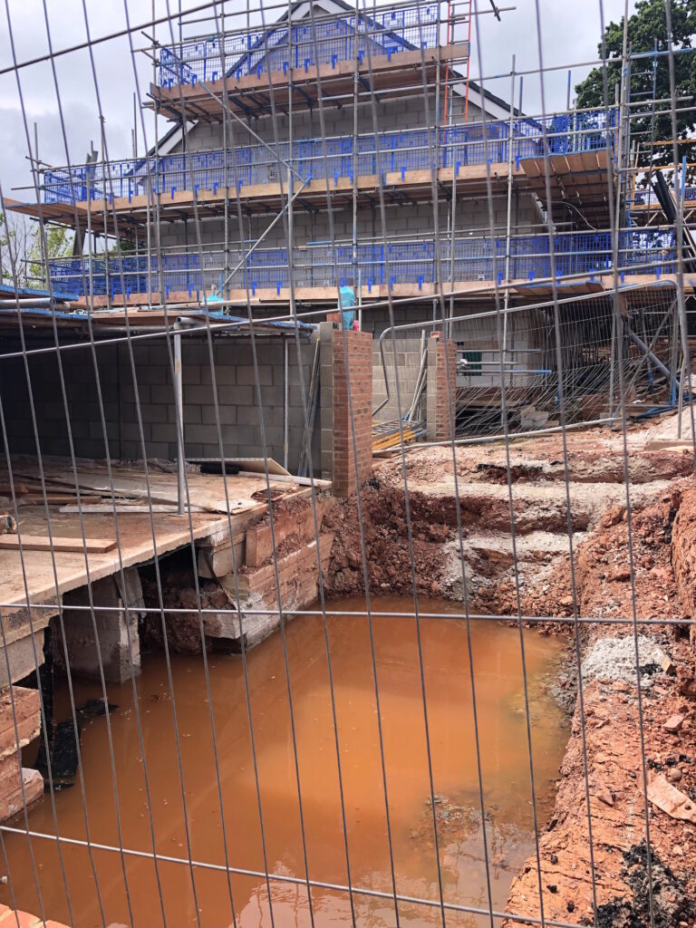
NOTE 2: Following a month of dry weather with limited rain, photo evidence was submitted after limited rainfall on 23 July 22, showing water accumulating in the underbuild of the coach house, one of the final properties being built on Home Farm site near Church Hill, three units down from Higher Field.
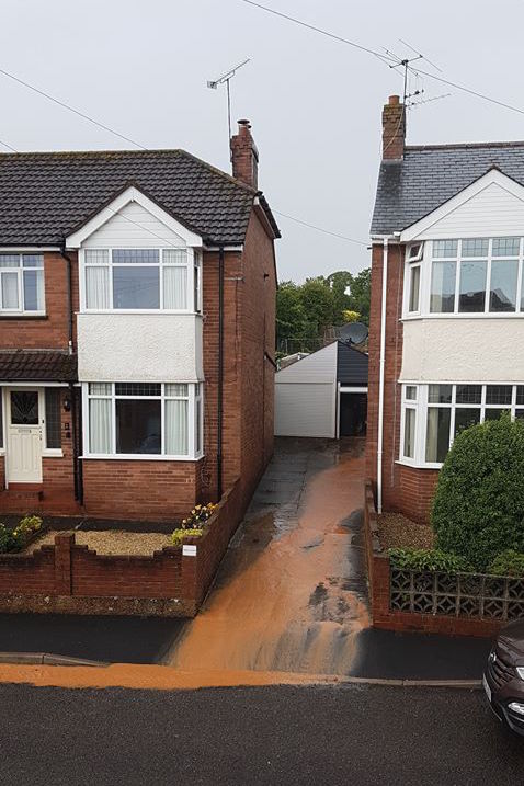
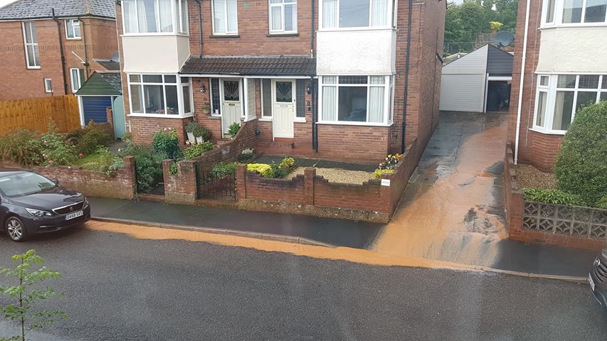
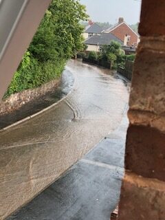
Home Farm, July 2022

SUMMARY
• Evidence submitted by residents shows persistent flooding from the current Home Farm site.
• This flooding is damaging property and impacting road safety.
• As extreme weather events increase in regularity and severity, modelling exercises to develop flood plans and Strategic Flood Assessments will need to ensure protection for resident safety and property security across a wide area across Pinhoe, as this evidence demonstrates.
• Hedgerows and hedge trees provide excellent weather barriers and habitat for wildlife; as part of natural flood management they significantly increasing water infiltration rates into soil, reducing surface run off and overland flow. Hedgerows help to prevent soil erosion and stop soil sediment reaching rivers. The removal of multiple sections of tall Devon hedgerows is contributing to compromised effectiveness of water management measures on the current site. Further reduction of existing green infrastructure not only damages the character
of the natural landscape but would further exacerbate flood water flow.
• The case for the retention of Higher Field as protected greenspace, with enhanced protection for boundary hedgerows and field trees is made stronger by this evidence from our local community and more urgent by the undeniable impacts of climate change.
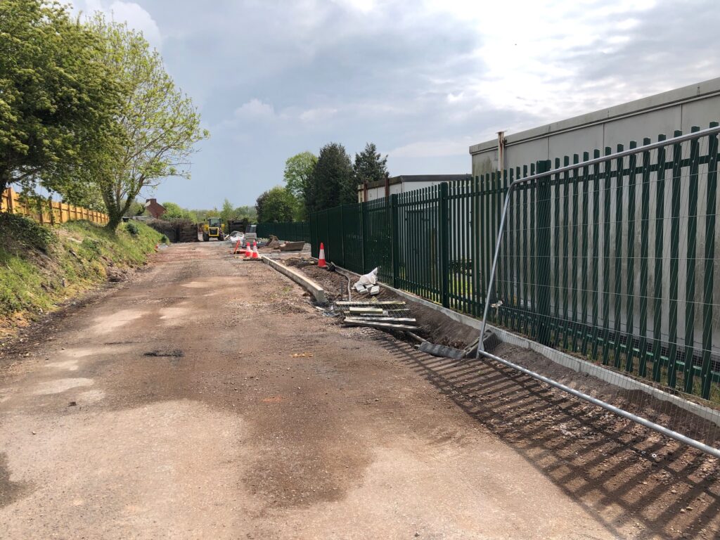
Highways update: Langaton Lane timetable, Pinhoe Station works and some bad news for Parkers Cross

As work continues on the new car park at Pinhoe Station, the weblink for further information about the closure of Langaton Lane is now live: devon.cc/langatonlaneetro

Pinhoe Station Interchange

Devon County Council Senior Transport Planning Officer, Liz Holloway replied to our request for further information regarding the integration of plans for Langaton Lane into the overall strategy for Pinhoe (link to the Pinhoe Area Access Strategy + Addendum is available on our data resource tab):

“The green lane for Langaton Lane has been listed as a priority scheme within the Exeter Transport Plan (Nov 2020). Prior to adoption of the Exeter Transport Strategy, our Scrutiny Committee Members recommended that the strategy should seek to include green lanes to better connect villages so that places like Ide, Pinhoe, Cranbrook and Woodbury on the outskirts of the city have better walking and cycling options to link into Exeter’s cycling network. This is in line with the latest government National Planning Policy Framework (NPPF).

“The ETRO for Langaton Lane will be in place for a minimum of 6 months, and a maximum of 18 months, after which the scheme would either be made permanent or removed. This decision will be made at a future East Devon Hatoc meeting where data and findings will be presented.

There are plans to introduce a crossing near Parkers Cross Lane, although designs are in the early stages and limited resources are available to progress this.

Despite requests no further information was provided regarding resilience measures for traffic travelling through the village, raised formally by East Devon District Council during WestClyst development decisions as part of plans for the Langaton Lane Linkroad (LLL).

Speed Cameras for Pinhoe

In the summer of 2021 we ran a number of polls on our social media pages, to see whether people in Pinhoe felt speed cameras would help with traffic speeds across the village.

After resounding public support, Pinhoe Village successfully applied to the Vision Zero fund for a camera with 3 separate location brackets.

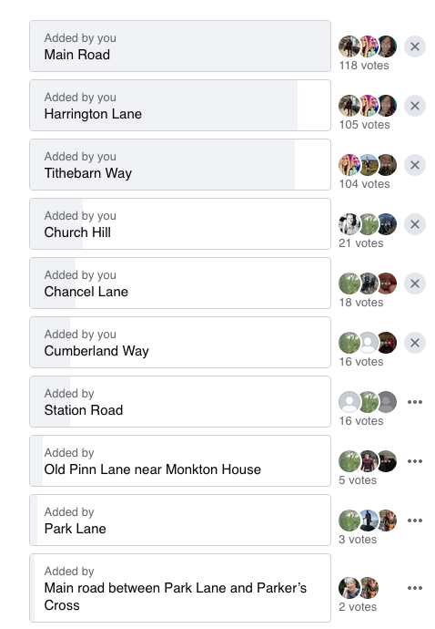
At the end of March 2022, we ran another poll to test options for camera locations:

Vision Zero have asked WHERE we’d like our new speed cameras for Pinhoe so they can coordinate with the Community Speedwatch Team. Their safety assessment teams will identify the exact positions, so please vote for roads / streets where you see the biggest problems with speeding >

Comments included the following main points:

“It’s getting very busy around Pinhoe, even the pedestrian crossings aren’t safe. It’s a good idea to have cameras”

“I jog around Pinhoe and there are certain roads where the speeds are crazy! My top 3 are: Tithebarn Way, it’s a race track from the roundabout to the speed bumps and trying to cross as a pedestrian is dangerous as there’s no crossings either, particularly at the top of Pinn Lane to get to the footpath. Causey Lane – again far too fast especially at night despite parked cars. Main Road – supposedly a 20 zone from the bridge but that’s ignored”

“We live in Honey Lane and our garden backs onto the main road. The speeds I hear cars going at on the main road are ridiculous. Would also say on Harrington Lane, when taking my kids to school, cars are often going at dangerous speeds”

“Cars slow down for the speed camera in West Clyst, then speed back up again heading into Pinhoe.”

“The speed they go past Mosshayne Lane is ridiculous, especially motorbikes! I was pulling out of our drive along there the other day and a car was overtaking another car having just gone through the speed camera towards Broadclyst!”

“As much as I see the need for the speed cameras I feel they may increase the likelihood of accidents. As people speed then slow down then speed up again once passed, especially if they aren’t used to seeing them they could cause people to brake hard to avoid getting flashed which increases the chance of an accident (I know they shouldn’t be speeding in the first place). In my opinion the cameras worked best when they were hidden, as you had to stick to the limits as you didn’t know where they were.”

“Don’t install any cameras, they are just seen as a cash cow. Put up a couple signs with the image of a camera, that works just as well. And have a police officer walking around occasionally, watching the drivers”

“I think Harrington Lane, its a good stretch of road that some car speed down and there is no traffic system in place. I’ve just been to the park with my two little ones and walked back and seen two car speed down the road and they certainly weren’t doing 20. Plus the school is along that road too”

“I liked where original camera near the library on venny bridge as motorists did slow down if not got a fine”

“Being a local delivery driver in the area I would say Harrington Lane because of the school. Children’s safety is paramount. They need a new speed hump along Tithebarn Way at the junction with Pinn Lane as it’s so dangerous getting out of there on that blind bend and would help with pedestrians crossing”