LIDL STORE APPROVED

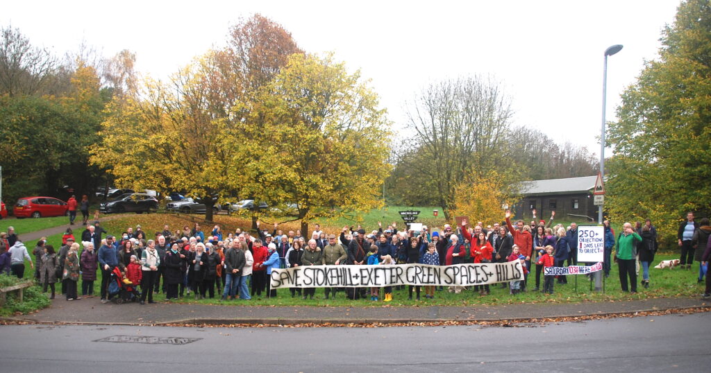
Despite 70 public objections and safety concerns about adjoining highways infrastructure, this new supermarket development was unanimously supported by the City Council planning committee on Monday 21st February 2022

Exeter City Council Planning Committee Political Balance (source: Exeter City Council)

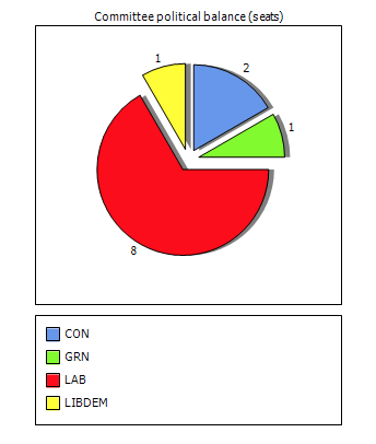
Cllrs Rachel Sutton (Exwick) and Keith Sparkes (Topsham) thought it would be “good for Pinhoe”. Cllr Duncan Wood (Pinhoe) represented local residents’ views and his own lived experience living near to the development; however he was unable to provide technical evidence or data as requested by Council leader Phil Bialyk. There were no representations by local residents, nor by Pinhoe’s county councillor with responsibility for Highways.

Summary Concerns

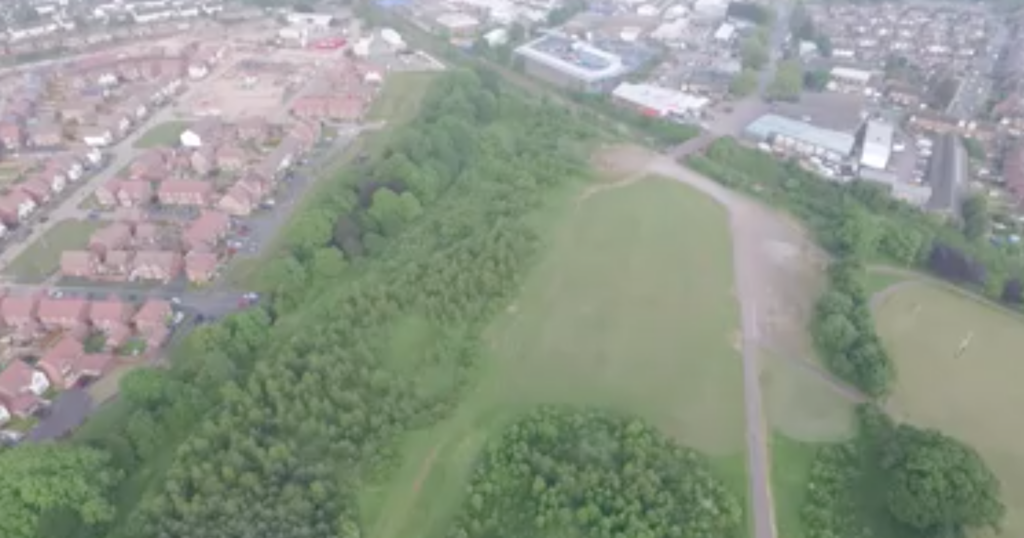
Pedestrian access is restricted to a narrow pavement along this busy main road, especially now Aldi have built right up to the pavement and removed their green planting. Walking single file makes it difficult to navigate safely with children, prams, buggies or walking the dog.

Traffic congestion is already a problem at Venny Bridge. There are multiple safety concerns and major infrastructure problems at Chancel Lane Bridge, already known by Devon County Council and Highways.

Planning Committee Discussion

Highways approved the provision of two additional toucan crossings to prioritise cyclists and pedestrians; they agreed the plans as an “acceptable solution”. Noting the expected increase in traffic, estimated at 10% by 2024, would not have “a severe effect”, Highways did not remark on the impact of traffic on adjoining routes.

Despite cumulative queuing from multiple traffic lights in short succession, Exeter Council officers advised that air pollution would have minimal impact on local residents as “pollution dissipates very quickly”; the new housing development immediately opposite the Lidl site was not discussed. There was no mention of the effects of localised air pollution for cyclists or pedestrians. There was no discussion of site enhancements or public amenities, nor investment opportunities for critical infrastructure protection or safeguards

AN OPPORTUNITY TO REIMAGINE THIS AREA >

• extending the pavement along Aldi by reducing two lanes of traffic into a single lane, creating wide, accessible, safe connection between retail sites and all residential areas – from Hill Barton and Whipton, Summerway and Pinhoe

• street trees along Cumberland Way right up to Lidl’s doors, to make walking and cycling more enjoyable

• a new plan for Pin Brook to upgrade blue infrastructure to the rear and side of this site

• enhancing Pinhoe’s Trading Estate to reconfigure access routes and revive this business area, attracting local investment

Commercial, public and strategic infrastructure require long term planning including consultation and local trust in community engagement to create these opportunities

Let’s get some air pollution monitors in Pinhoe!


In a public statement, Pinhoe’s Labour City Councillor Duncan Wood confirmed:

“This is a vastly improved proposal than that presented in 2019 and Lidl has listened to some of our feedback whilst still firmly focused on building on this site. I spoke of the inappropriate location, remaining reservations about the junction, flooding implications and Chancel Lane Bridge. Also challenged the assumptions around sustainable travel to it by bus or walking for obvious reasons. Members listened and asked further questions but ultimately followed Officers recommendations and approved the application. It will certainly be good to see the junction improved as a result.”

JOIN THE MOVEMENT!

Objecting to housing development proposed on farm land above Mincinglake Valley Park

Photo by Francis Hallam, Saturday 20th November

Plans have been submitted to the City Council for a large development of 150 new homes and facilities on farm land next to the barn adjacent to Mincinglake Park. This greenfield site is an important gateway to the Northern Hills and the network of Valley Parks, used and loved by people across the city and a vital nature corridor for wildlife as part of our city’s green skyline.

Thanks to advice from a planning specialist, local groups of residents have been able to confirm this application is contrary to policies in Exeter’s Local Plan and against national planning policies. This site is not allocated in the current Core Strategy and is a greenfield site in a protected area. 

We urge you to join our protest by submitting your personal objection to the City Council

To object please consider using the information below. It is important that you include your own personal introduction. You will need to register on the Exeter Council Planning Portal https://exeter.gov.uk/planning-services/permissions-and-applications/find-and-comment-on-a-planning-application/how-to-make-a-comment/  and use the reference 21/1291/OUT or you can email your objection directly to case officer Matthew.diamond@exeter.gov.uk  quoting the same planning reference 21/1291/OUT

We believe this application  should be opposed on the grounds of: 

LANDSCAPE – this application represents significant harm to the landscape and is contrary to saved landscape in Local Plan Policy H1 (thanks to Naima Allcock for this update) and policy CP 16 of the Core Strategy which protects the Northern Hills and their link to the Valley Parks. 
The Northern Hills have long been regarded as marking the boundary of the city and have been protected by all previous versions of the Exeter Local Plan. They are a very distinctive feature which are locally designated. Building on these hills will have a significant effect on the wider landscape, visible from other areas of Exeter

PROTECTED SPECIES – this application risks significant harm to protected species such as bats,  dormice and newts, with insufficient  alternative habitats proposed for them contrary to paragraph 180 of the National Planning Policy Framework. The developer has suggested that the detail of providing alternative habitat to later. However there has been insufficient assessment of sites

LOCAL IMPACT– this site provides an important link from Mincinglake to the Northern Hills as part of the unique green landscape in the North of the city. The application represents loss of recreational space and is contrary to policy CP16 of the Core Strategy. In addition, building on the boundary of the park will have a detrimental effect as an “alternative natural greenspace”. Any amount of levy would be of no consequence if the park it is supposed to enhance is seriously harmed

HIGHWAYS – this car-led proposal is some distance from larger shops, schools and other facilities, risking serious harm to pedestrians, cyclists and horse riders using the very narrow Stoke Hill Road due to significantly increased numbers of vehicles using the proposed access north of Mincinglake Bridge . This would be contrary to paragraph 112 of the National Planning policy framework

AIR QUALITY– any increase in the number of cars using the Stoke Hill roundabout would have a significant detrimental effect on the health of pedestrians and cyclists as well as residents living close to it, due to increased congestion. This is contrary to policy CP 11 of the Core Strategy

LAND CONTAMINATION – there is clear evidence of contaminated land in the application area. If not dealt with correctly this could lead to contamination of waterways or ground water within the important wildlife area of the Valley Park

Eastern Fields’ Village Green

Here’s some info about the 2016 campaign to stop a road cutting through Eastern Fields:

“We are a group of local residents who are fighting to save an urban green oasis & register it as a village green to keep it safe for future generations.
Eastern fields is a much used and valued green space between Exhibition Way and Harrington Lane, Pinhoe Exeter. It is surrounded by housing estates and industrial land. It has been used since the 1950’s for informal recreation. In recent years the city council has spent thousands of pounds in planting young trees to encourage wildlife and these areas of trees are growing well and the birds, insects and animals have all moved into their new habitat. It also has a new and much used cycle path linking two primary schools as well as other destinations and is valued for the safety and peacefulness of the route. It is a tranquil and pleasant environment. It is a place where children have played for generations, whether ball games or building dens. Eastern Fields is a green space in an urban environment. It is valued for all the benefits that green and open spaces give to people.
There are massive developments planned for the eastern side of the city and Eastern Fields will be even more needed as green space. The area is important to our community and we do not want to lose it. It is a unique and beautiful place and part of our local history. Our city council is planning a link road through the field as well as industrial development on the lower half. We do not believe it is necessary to have industrial development on this land given the extent of land in the surrounding area already being developed for industrial use. Neither do we believe that the proposed road would solve Pinhoe’s traffic problems to the extent that merits the loss of such valuable recreation land and wildlife habitat. As people and residents who value the field we are therefore campaigning to try to preserve and protect it.”

The campaign video has some brilliant shots of the connection to Cheynegate Lane and you can just about see the walk to the top fields >

CAMPAIGN VIDEO

You can also see the connection through to the business park, with a clear view of the track for the proposed Highways Link Road >

We’re looking for documents which evidence the process of campaigning, as well as Council planning and appeal – please get in touch if you can help with this #localexpertise! mail@portfoliofive.co.uk